The Starting Point
Just like yesterday for the Preikestolen hike, we started our drive from Raddison Blu Royal Hotel, Stavanger. After breakfast, the kitchen handed us our lunch pack for the hike. It was God-sent.We departed at 9.30am and expected to arrive at the Kjerag car park at 12 pm. Up next was a 155 km drive down E39 and then continued onto Rv503 and RV45.
We also managed to check out the Gloppedalsura Scree on the way. The field is made up of avalanche boulders that happen to pile on top of an end moraine 10,000 years ago. Driving through this area made me feel so tiny, as if this place were created for the Giants. Legend has it that Trolls used to play hide and seek in the area while some turned into stones when the first ray of sunlight hit them. Apart from that, the Gloppedalsura played an important role in World War 2.
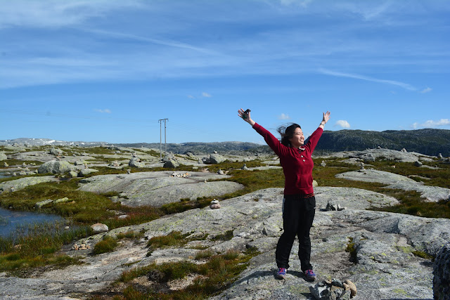
Generally, the route to Kjerag is very scenic. There are lakes, rock piles, green fields and some fresh snow along the way. Yes, snow fall during this time of the year (July) is possible, so be prepared for that.
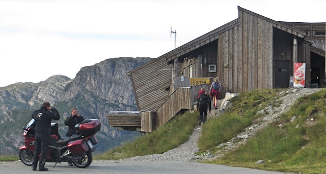
We reached Øygardstøl on time, again opted for the paid car park (200 NOK) and started the hike right away. If you are not fully mentally prepared for the hike, I recommend stopping by the information kiosk, check out the trail map and have a hot coffee at the cafe… then hit the trail fully energized!
The Hike
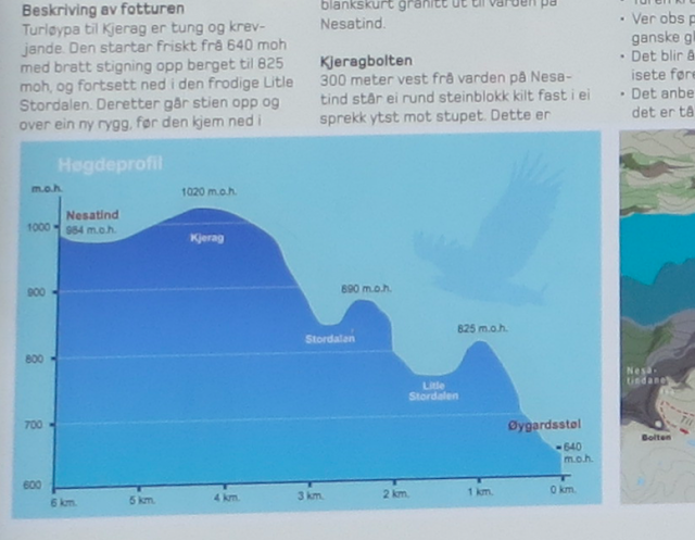
The trail head is just behind the car park. Bear in mind that it is a 11km hike with 3 very steep inclines you’ll have to go through, but don’t be discouraged, there are metal chains installed to assist you and for your information, we were hiking behind a mother with a toddler on her back and 2 five-years-old looking children… so I would say don’t put yourself down because if there’s a will, there’s a way.For an overview, look at this guide from Visit Norway and check out their safety advice.
Now if you are still worried, read on as I break the hike into point-to-point journeys for easier understanding:
Part 1: The steep Incline A + Decent A (Little Stordalen)
This ascent was challenging for me as a pretty inexperienced hiker (The only moderate-difficult hike I’ve done was in Yosemite). However, looking at the kids going in front of me ignited my spirit and thanks to them I had the courage to move on.At some most difficult part of the route, there will be metal chains for you to hold on, but don’t make the mistake I’ve made… Do not be too dependent on the chains because your body will tend to lose its balance. You’ll have to bend low, putting your center of gravity as low as possible. Also, use your hands. You can crawl if you need to (at least I did).
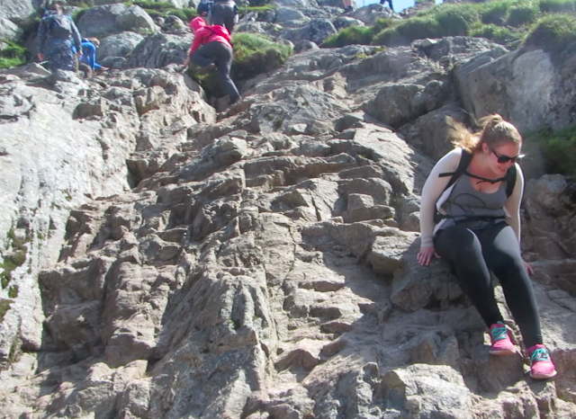
My first decent was a daunting experience. Due to the fact that I could then see how high up I was, I was terrified. And there was a time I just stopped and sat on the steep rock clinging tightly on to the metal chain. If it wasn’t for my travel buddies who encouraged me to stand and even threw out our phrase of the day at Preikestolen “If dogs can do it, you can do it”, I would just abort the mission. To clear things up a bit, there were no small dogs on the trail that day… only bigger dogs such as the German Shepherds.
Part 2: Green Valley
After the nerve-tingling Incline A experience, the sight of flat ground was most welcomed. We rested a little, chatted with a German hiker, filled up our water bottles with the crystal clear water from the stream and then go on.Part 3: Steep Incline B + Descent B (Stordalen)
Our first Incline taught us a thing or two. Although the Incline B happens to be the steepest among the 3, this time, we were high-spirited, prepared to take on any challenge. This ascent has more big rocks and holes for you to hold on. We scrambled around, picked up our speed, reached the top sooner than expected and even had a KitKat on top (rest time.)However, we felt that we might not be able to reach Kjeragboltcen on time and we agreed on turning back if we did not make it before 3 pm.
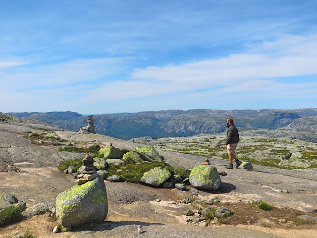
Thank God there is a few hundred meters of flat ground before we had to work our way up again. Love the view here in this small valley.
Part 4: Steep Incline C (Kjerag)
Incline C is the longest climb up.Everything was going as planned until the weather took a sudden turn. Strong wind started blowing like no tomorrow when we were half way up Incline C. I remembered holding on to the chains for dear life as my body was half "flying" in the air (I am about 40kg). We started to worry about the 2 children and the mother with a toddler. We had lost sight of them since Incline B… hope they were on the flat ground during this weather condition.
On Incline C, I don’t remember exactly how many times we asked each other “Should we turn around?” but I am sure it's over 8 times. Also, we had 3 discussion breaks about turning back in the midst of the strong wind… The worst thing about this incline is, there isn’t any big rock along the way where you can hide from the wind, it is just a steep rocky surface with chains.
Fortunately, hikers on their way back encouraged us to move on. According to them, this incline does not have a descent. On the other side, there will be flat ground sheltered from the strong wind all the way to Kjeragbolten. And so, knowing that we’ve been through the difficult parts, we braved the wind in strengthen determination.
Part 5: Flat Ground
Glory to God. We’ve reached the flat ground after numerous thoughts of turning back and we were glad we didn’t.Part 6: Rocks and Creek
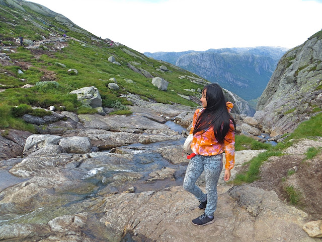
A signboard indicated us to take a turn into a narrow alley where slippery rocks and a small stream lined the way. Please be extra careful on the rocks. Hopefully, you’ll be traveling with some good travel buddies like mine, we got each others’ backs.Here, you’ll be able to see the Kjeragbolten right ahead of you. In our case, we had to step carefully through a snowy area before we got to “safe ground”. Experience varies according to weather and season!
We are here!
We made it right on time, 3.00pm. Prior to the hike, I’ve shown Sabina and Suan a video of hikers going out to the boulder, and we agreed that safety always comes first and we should never do it…. Well, not after this Adrenaline rush!Sabina was the first to step out to the boulder followed by me and Suan. However, the wind was still going strong, we decided not to stand. Despite some comments online stating that the queue to the rock will last about an hour, there isn’t anyone else in the line. I guess everyone was still struggling between to do it or not to do it.
YOLO (You only live once), but you only die once too. So even after my experience standing on the boulder, I’d advise my readers to do things within your ability, especially those with a fear of height. Do not be influenced by peer pressure. This act is not for everyone, one misstep could send you to heaven (if you’re a good person). When we were there, we saw several people who needed help coming back from the edge after having last minute change of mind.
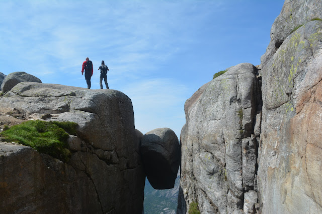
There is a path, about half a meter wide (I don’t consider the smooth rocks at the side “path”, do not step on it as you might slip), hidden from the cameras for hikers to walk on to the boulder. There used to be a metal chain on the wall beside this path but it broke earlier, leaving merely a knot behind. (I wonder what happened to the person who last used the metal chain…)
After the path to the boulder, there will be a tiny “line” between the boulder and the cliff where you can see the sheer drop below. If you are like me, a little afraid of height, try sitting down, putting your feet on the boulder and then push the cliff behind you to propel your body forward to the boulder. Land with both hands. Then congratulations, you are on it. Pose at your own risk.
If you couldn't image it, here is a video to help you understand:
** Note: I’ve also seen people jumping onto the boulder effortlessly. Apart from that, when we were still walking on the snow, we saw a man proposing to his girlfriend on the boulder. We joked about it later on because the girl is in no position to turn down the proposal. (What will happen to her if she says no? Probably nothing. We are just some evil kids.)
The Descent
Too bad we had to backtrack all the way back to our car. Luckily, I am in good company and we sang “The Climb” by Miley Cyrus along the way. We literally jumped up and down when we finally saw the car park right beneath Incline A. “The Car Park” became our motivation descending the steep rock.The Verdict
If you are physically fit and mentally strong, you should go for the hike! Although it might be too tough for us, we made it back to the base in one piece, and the effort was totally worth it. The driving wind only added to the experience and I bet those memories will never fade away.As for me, stepping out to the boulder is a once-in-a-lifetime experience, I would not do it again… and to my future kids, you are not allowed to do it as well because mom says so.
Where to Stay
I made Stavanger my base for all hikes in Lysefjord. If you would like to stay nearer to the trail head, the closest town is Lysenbotn, which is 15 minutes drive away. Also, I recommend these properties below (I've included links to booking.com, please check the reviews before booking):1. Flørli 4444 >>
This hostel is a top-rated one in the area. Not only that the hostel is located next to the world's longest wooden stairs (the Flørli Stairs with 4444 steps), guests are blessed with an incredible view of Lysefjord from the property. However, A car-ferry ride is required to reach the place, so it might not be an option for travelers outside the season.
2. Sirdar Høyfjellshotell >>
This is a hotel recommended to us by the representative from Visit Stavanger, so I am sure it is a nice property to stay in. The Lysefjord is only a 45-minute drive away.
3. Heiland Apartments >>
This apartment in Årdal can be your choice if you want to be close to both the Pulpit Rock and the Kjeragbolten. Stavanger is a 1-hour drive from the property, the Pulpit Rock is a 40-minute drive away, while Lysefjorden is a 30-minute drive away.
4. Heiland Gard >>
If you want to stay close to the beach, this property is a 12-minute walk to the beach. and It's located 5 minutes’ drive from Årdal village.
-----------------------
Follow me on Instagram if you would like to see more photos!
📌For more travel tips, like Eat Love Travel Breathe with Miss HappyFeet.
📌Subscribe to the monthly newsletter for exclusive travel deals, tips, free E-books, monthly giveaway and travel coupons!
----------------------
Thank You for Reading! Miss Happy Feet was hosted by Visit Stavanger but all photos and opinion are as always my own.
If you too have hiked the Kjeragbolten, feel free to share your thoughts with me by commenting below








No comments:
Post a Comment